
Reminiscing the 70s: Old 1969 Maps of Moulmein, Balestier, Kim Keat, Thomson, Novena, Rangoon, McNair, Norfolk, Kampong Chia Heng

Jalan Toa Payoh upgraded to PIE, our first expressway in Singapore, carving Toa Payoh away from Moulmein. Ah Hood Road, Boon Teck Road and Kim Keat Road was disconnected to make way for PIE.

Jalan Bunga Raya gave way to condominium development.
3 schools used to be atop Balestier Hill
Ah Hood Gardens used to have Nam Ann Chinese School
A church made way to Ah Hood Road leading to Jalan Rajah

Hoover Theater made way for Shaw Plaza
Ruby Theater replaced by award winning architecture Balestier Point
The current Curtin University used to sit Kim Keat Secondary Vocational School
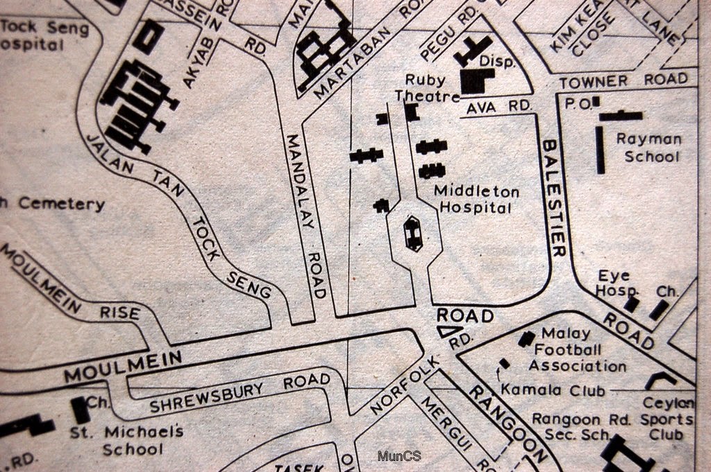
Moulmein Circus was the main interchange of human traffic and transport system, bounded by Moulmein Road, Norfolk Road, Rangoon Road and Balestier Road. A replica of today's Raffles, City Hall and Dhoby Ghaut MRT Station.
Norfolk Road upgraded to CTE, our 3rd expressway. (ECP was the 2nd expressway and AYE later was the 4th expressway)
Middleton Hospital is now the current Communicable Disease Center.
Towner Road is split by CTE, with one half renamed as Whampoa Drive.
Map provided: Courtesy by Mr Mun Chor Seng.
Highlights of Reminiscing the 70s by verbatim and recollection: Courtesy by Mr Patrick Lim